In brief
- Geographical map of Corsica: a territory with striking reliefs, between mountains and coastline.
- Understanding the topography (massifs, rivers, valleys) facilitates exploration and route planning with the family.
- Connecting the main towns (Ajaccio, Bastia, Calvi, Bonifacio) while considering the winding roads and real travel time.
- Choosing routes and sceneries suited to the needs of toddlers helps reduce parental stress.
- Practical resources and tools: road maps, topographic maps, local guides, and parental support advice.
A brief guide for parents seeking a peaceful trip: the geographical map is the tool that turns the unknown into a controlled itinerary. The common thread linking these sections is the Moreau family, a couple with a newborn, who illustrates step by step how to prepare and experience a gentle exploration of Corsica.
Geographical map of Corsica: general overview of the territory and topography
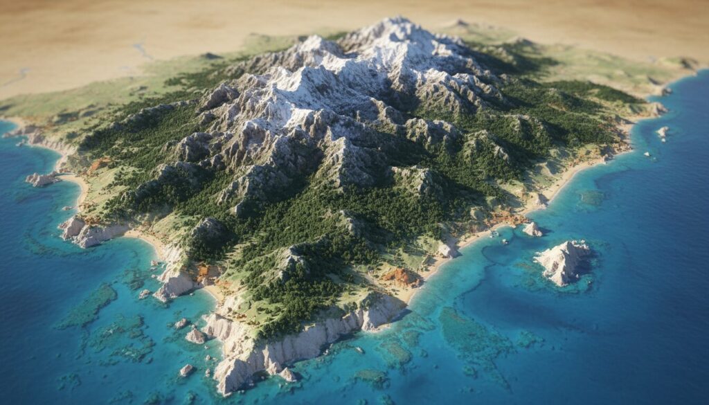
The geographical map of Corsica reveals a territory where the sea and the mountains continuously interact. The island, with an area of about 8,722 km², presents a density of remarkable sites concentrated in a relatively small space. For the Moreau family, this contrast means that within a few hours of driving, a coastal landscape can give way to a high plateau or a mountain cirque.
On the map, topography is first read through contour lines and main massifs. The peaks, often exceeding 1,500 meters, structure the heart of the island. These reliefs influence the local climate, creating micro-regions: corridors where warm sea air meets cool altitudes, perfect for cooler naps for a baby in summer. Understanding this layout helps plan the day and breaks.
Massifs and altitude: what a map shows
On a topographic map, a relief is identified through contour lines. Tight zones indicate steep slopes to avoid with strollers or trips involving a newborn. Conversely, more spaced zones indicate plateaus and welcoming valleys. For the Moreau family, spotting these variations was enough to choose stops with easy access and observation points without excessive physical effort.
Corsican massifs concentrate mythical trails like the GR20, but the map warns: some routes require endurance and equipment that are not suitable for young children. Opting for marked hikes near towns or villages is a calmer strategy.
Administrative division and urban landmarks
The geographical map clearly distinguishes urbanized zones and protected natural areas. On the island, two urban poles guide orientation: Bastia in the north and Ajaccio in the south, each serving as a base to reach nearby sites. Tourist maps also indicate small essential communes — Calvi, Bonifacio, Propriano, Île-Rousse, Porto — which punctuate the Moreau family’s journey.
Topography also influences the density of roads. On the map, main axes are not always highways; they adapt to the reliefs, winding through curves and valleys. Measuring these roads via a map helps anticipate travel time and needed breaks.
For a parent, careful map reading guarantees stops suited to the baby’s needs: frequent breaks, shorter trips, and alternatives in case of weather changes. This skill turns departure anxiety into concrete confidence.
Final insight: mastering map reading allows anticipating the terrain and adapting exploration to the baby’s rhythms.
Reliefs, rivers, and natural obstacles: practical guide for peaceful exploration
On a map, rivers and valleys often shape natural circulation axes. The Moreau family learned to use this information to choose calm stops near watercourses where the air is often cooler and the atmosphere soothing for a toddler. Corsican rivers, sometimes short but powerful, are secure landmarks for breaks, provided local safety rules are observed.
Reading reliefs on the map allows anticipating physical effort and avoiding risky zones in case of storms. Parents benefit from spotting watersheds and torrents on the map since topography determines sudden water flows. Preparing a route considering these elements reduces surprises.
Concrete examples of adapted itineraries
A typical half-day itinerary: start from a coastal town, take a panoramic road to an accessible valley, park near a small parking spot shown on the map, and take a very short trail to a water point. The topography read from the map allows choosing a flat path rather than a steep one. For the Moreau family, this type of day often ended with a nap by a river while the accompanying parent took time to admire the landscape.
Another example: avoid a mountain road marked by closely spaced curves when traveling with a baby on board. Prefer a coastal route, even if it slightly lengthens the trip, offering more possibilities for frequent stops and open spaces.
Practical table: main massifs and rivers
| Element | Location | Characteristic useful for parents |
|---|---|---|
| Central massif (Monte Cinto) | North-West | High altitudes, panoramas, winding roads to expect |
| Monte Rotondo massif | Center | Access to cool plateaus; good summer stops |
| Restonica torrent | Near Corte | Short walks and natural pools suitable for breaks |
| Liamone river | South-West | Wide valleys, options for picnics and discovery |
This table helps cross-reference topographic information and family usage. In 2026, interactive cartographic resources now include filters “stroller accessible” or “baby stop,” helpful to save time during planning.
Final insight: spotting rivers and valleys on the map transforms every break into a safe and refreshing moment for baby.
Towns, roads, and capitals: organizing stops between Bastia and Ajaccio
The geographical map highlights two major urban poles: Bastia in the north and Ajaccio in the south. Historically, other towns like Biguglia played an administrative role, reminding that urban networks evolve over time. For traveling parents, these towns serve as logistical anchors: health services, child equipment stores, pharmacies, and suitable accommodations.
Corsican roads are often scenic but winding. Careful map reading shows that announced travel times can be optimistic; it is better to factor in longer travel times to include breaks and contingencies. The Moreau family chose to prioritize trips in the mornings and late afternoons to avoid heat and summer traffic.
Practical tips for trips with baby
- Plan regular breaks every 45-60 minutes by checking areas or parking places marked on the map.
- Select accommodations close to points of interest to reduce transfers.
- Check for medical services in the towns along the route.
- Prepare an emergency kit and choose main roads rather than mountain detours at night.
For parenting advice adapted to travel, it may be helpful to consult specialized resources. For example, practical articles are available at practical advice for traveling parents, offering tips for packing and managing naps in the car.
The geographical map also helps visualize alternatives: if a road is closed for works, the map allows quickly identifying a detour with possible stops. This reassures parents and reduces stress related to the unexpected.
Final insight: using the map to locate services and travel times helps organize realistic and calm stops.
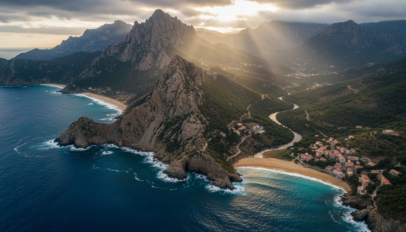
Sceneries and must-visit routes: beaches, cliffs, and villages to discover with family
Corsica offers a variety of sceneries: fine sandy beaches, steep cliffs, perched villages. Reading a geographical map guides the choice between a beach day and a highland escape. For the Moreau family, alternating these experiences greatly facilitated the baby’s adaptation to changing rhythms.
Some routes recommended by the map: the coastal road between Calvi and Île-Rousse, the descent to Bonifacio and its cliffs, the crossing towards Porto and the Calanques of Piana. Each route offers stops marked on the map to eat, change baby, or simply observe the landscape.
Family-friendly sites
Sheltered beaches, such as some coves in the south, offer easy access for strollers and a calm environment for outdoor naps. Villages like Propriano or Porto-Vecchio have favorable infrastructures (restaurants with high chairs, beach access without steps). The tourist map allows identifying these services in advance.
Boat trips, indicated on certain maps, open another perspective: visiting calanques or observing marine caves without walking effort. For babies sensitive to the sun, these options offer controlled warmth and contemplative moments for parents.
For ideas on family support and adapted activities, the parental support platform promoted by professionals recommends simple gestures to soothe babies during transitions, such as portable sleep routines and gradual transitions between spaces.
Final insight: choosing sceneries according to the baby’s needs turns an outing into a shared memory rather than a logistical challenge.
Practical cartography: tools, road maps, and tips for controlled exploration
No matter the experience level, combining a good map and a realistic plan is the key to peaceful exploration. Classic road maps (Michelin, Routard) remain useful to visualize roads and distances. Interactive maps now allow adding practical filters: points of interest for children, accessibility levels, and recent reviews.
Tools and methods to prepare your trip
Start by tracing a main itinerary on a paper or digital map, then add stops every 45-60 minutes. Check for essential services (pharmacy, pediatrician, convenience store) near the stops. For the Moreau family, this checklist helped avoid stressful detours and anticipate unplanned nights.
Here is a practical list to consult before departure:
- Check alternative routes and realistic travel times.
- Locate health facilities and pharmacies on the map.
- Plan identified rest areas and local emergency numbers.
- Download offline maps for low network areas.
Useful resources
For more complete parental support, the Moreau family consulted specialized guides and articles, notably practical resources available on parental support, which gather tips and operational checklists.
Finally, a good practice is to print a small map extract and keep it accessible: in case of low battery or unstable network, a paper plan remains invaluable. Printed topographic maps also help spot elevation changes and choose routes compatible with strollers or baby carriers.
Final insight: combining paper maps and digital tools, with a pragmatic checklist, turns exploration into a controlled and calming experience.
What is the best period to visit Corsica with a baby?
The intermediate seasons (May-June, September) offer pleasant temperatures and less crowding. They allow for calmer trips and less frequented beaches, ideal for a young child.
How to quickly read a map’s topography to avoid slopes?
Spot the contour lines: the closer they are, the steeper the slope. Look for valleys or plateaus where the lines are spaced for easy strolls with a stroller.
Which resources to use to plan a family-friendly itinerary?
Combine a road map (Michelin/Routard) for distances, a topographic map for elevation, and interactive maps to find services and recent reviews.
What to plan for breaks during trips in Corsica?
Prefer breaks every 45-60 minutes, carry water, snacks, a changing blanket, and check for stops marked on the map for safety.